The road on the screen is assembled before it is animated
A conventional navigation map can be understood as lines, labels and symbols viewed from above. Google's Immersive Navigation tries to make the same route feel spatial. Buildings rise, overpasses cross above other roads, terrain has depth and selected details such as lanes, crosswalks, traffic lights and stop signs can become more obvious when the next decision demands them.
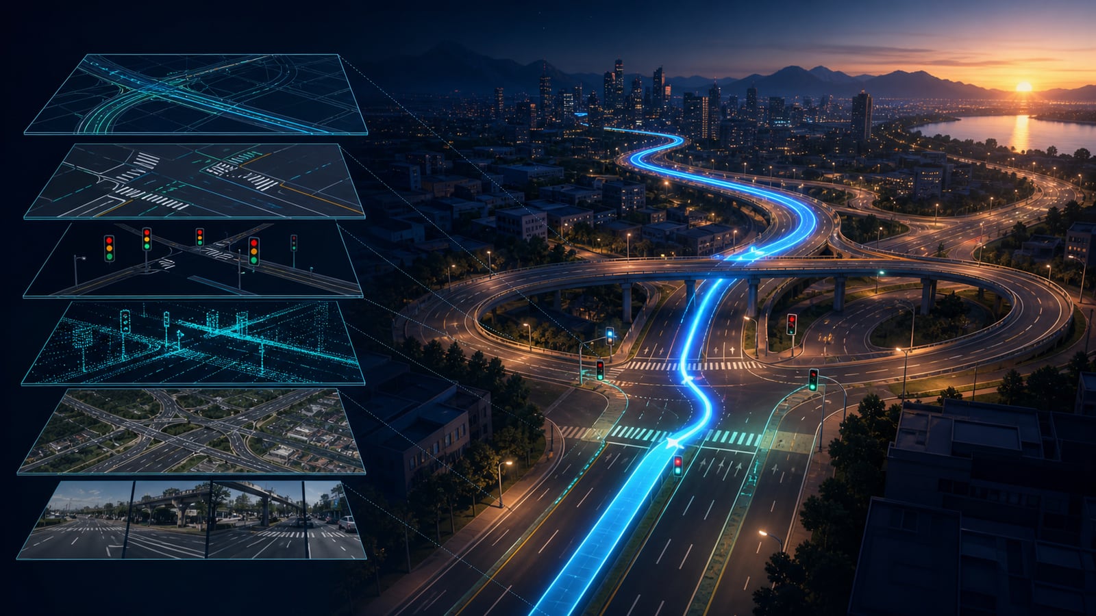
That does not mean a camera is streaming a perfect miniature of the road ahead. Google says Gemini models analyse real-world imagery from Street View and aerial photographs to create spatial understanding of a route. The result is a constructed view that brings several sources together. It is closer to a continuously updated model of the journey than a live window through the windscreen.
Street-level and aerial views solve different pieces of the puzzle
Street View records how places look from road level. It can reveal a building facade, a median, an entrance or the visual character of a junction. Aerial imagery provides a different kind of context: the shape of an interchange, the relationship between roads and the terrain surrounding them. Neither viewpoint alone explains every turn to a driver.
The 3D view combines that visual evidence with Google's underlying map of roads and places. The model must know which surfaces represent roads, where one carriageway passes above another and which details should remain visible from a moving viewpoint. That is why the feature is more ambitious than adding artificial height to a flat map. The scene has to preserve navigational meaning while the camera angle and scale change.
The view changes its emphasis as a decision approaches
A beautiful city model would be distracting if it hid the lane required for an exit. Google says Immersive Navigation uses broader route views, smart zooming and transparent buildings to show what lies ahead. The useful trick is selective emphasis. A distant skyline can provide orientation, while lane markings and the next turn become more prominent when the driver needs to act.
Voice instructions follow the same idea. Instead of announcing an isolated command at the last moment, the system can refer to what happens before the required manoeuvre, such as passing one exit and taking the next. Visual and spoken guidance then describe the same sequence. The 3D layer matters when it reduces the mental translation from an abstract diagram to the junction visible through the windscreen.
Slow-changing scenery and fast-changing traffic are separate layers
A building or overpass normally changes much more slowly than congestion. Google says Maps incorporates millions of traffic updates every second and receives millions of daily driver contributions about conditions such as crashes or construction. Those fast signals can be added to the route without rebuilding the surrounding city from the beginning each time a queue forms.
This separation explains how an immersive scene can look stable while its recommended route changes. The geometry answers where roads and landmarks are. Live data estimates what is happening on those roads now. Routing software weighs travel time and other costs, then the interface can explain a tradeoff, such as a faster toll road versus a longer route with less traffic.
The final hundred metres may need more context than the highway
Navigation often feels easiest during a long motorway stretch and hardest after the final turn. The destination pin may sit on a large building whose entrance is on another street, while the nearest car park has its own driveway. Google says the new experience can preview the area with Street View, recommend parking and highlight an entrance or the useful side of the street as the driver approaches.
That arrival layer is an example of why one coordinate is not enough. A latitude and longitude can identify a place without explaining how a person reaches its door. By combining the destination with imagery, road access and place information, the map tries to answer the practical question left after the route calculation: where should the vehicle actually stop?
A rising search does not mean every phone has the feature
Google announced Immersive Navigation in March 2026 and began its rollout in the United States. The company said availability would expand over the following months to eligible iOS and Android devices, CarPlay, Android Auto and cars with Google built-in. A later Android Auto announcement placed the feature at the centre of a refreshed in-car experience.
That wording matters. Rollouts can vary by country, device, app version, vehicle display and account. A sharp increase in United Kingdom searches during July 2026 shows curiosity, not universal access. If the interface still looks familiar, it does not necessarily indicate a fault. The most honest answer is that the feature is expanding, while Google has not promised that every eligible surface receives it at the same moment.
The real road always outranks the rendered road
A spatial model can make a complicated junction easier to read, but it cannot eliminate the age of its imagery, a temporary lane closure, a newly moved sign or an incorrect community report. Buildings and road markings may have changed after a photograph was captured. Traffic estimates can also change between calculation and arrival. Three-dimensional detail should increase understanding, not create false certainty.
Drivers therefore still need to follow actual signs, signals, road rules and conditions. Immersive Navigation is a guidance interface, not an autonomous driving system and not proof that every visible object is current. Its real achievement is quieter than the dramatic 3D effect: it tries to reduce the gap between a map's symbols and the physical decision a person must make next.
Sources and further reading
This article was written for Curiosity Desk. We do not copy other publishers or invent quotes. If a material error is found, we correct it openly.
Read the full standards →One answer should lead to a better question
Bring your curiosity to the group
Curious Minds is our public Facebook community for surprising science, strange history, Australian wildlife and everyday questions. No copied posts, no personal-friend invitations and no link dumping.
- Three self-contained discussion prompts each week
- Sourced answers and honest uncertainty
- Respectful conversation without spam