A current can carry the berg south
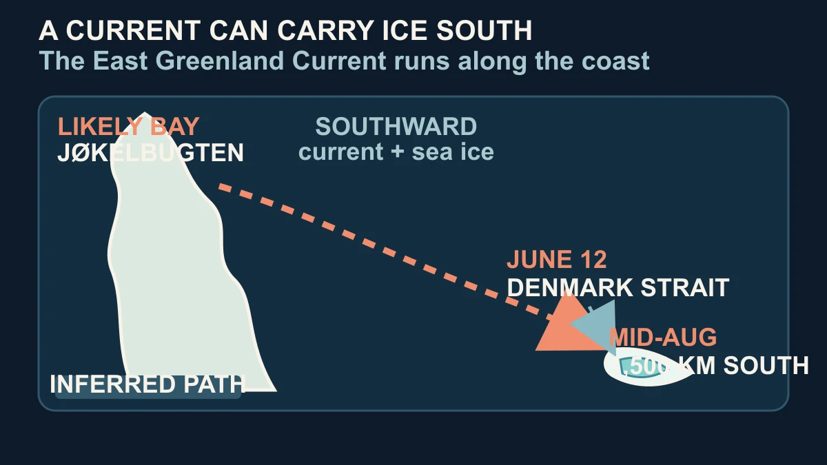
The short answer is that an iceberg can travel a long way when ocean currents carry it along the coast, while winds, tides and surrounding sea ice alter the details of its path. In the Denmark Strait, NASA describes the 2026 berg moving south on the Greenland Coastal Current into the North Atlantic. That gives the journey a physical direction without turning it into a perfectly straight conveyor belt.
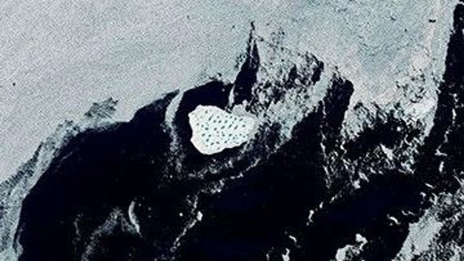
NASA's June 12 Landsat 9 image caught the iceberg in the strait between Greenland and Iceland, just south of Kangikajiip Appalia on Greenland's east coast. By mid-August, NASA reported that it was about 1,500 kilometres from the northeastern Greenland bay where it likely originated. The distance is a reconstruction across observations, not a claim that the camera watched every kilometre of motion.
A related NASA Earth Observatory account of sea ice in the same passage describes the East Greenland Current carrying ice southward and notes that the current can meander, with eddies pushing parts of the ice away from the main flow. The current feature uses the name Greenland Coastal Current for this berg's route. Together, those records explain the broad southward movement while leaving the berg's minute-by-minute track unresolved.
The sea around Greenland also changes what an observer can see. In spring, the bay and nearby coast can be crowded with sea ice and broken berg fragments, or mélange. A moving iceberg may blend into that background, so a path reconstructed from satellite scenes becomes clearer only when the surrounding ice thins and the individual berg develops a recognisable combination of size, colour and surface pattern.
Satellites find one iceberg by comparing clues
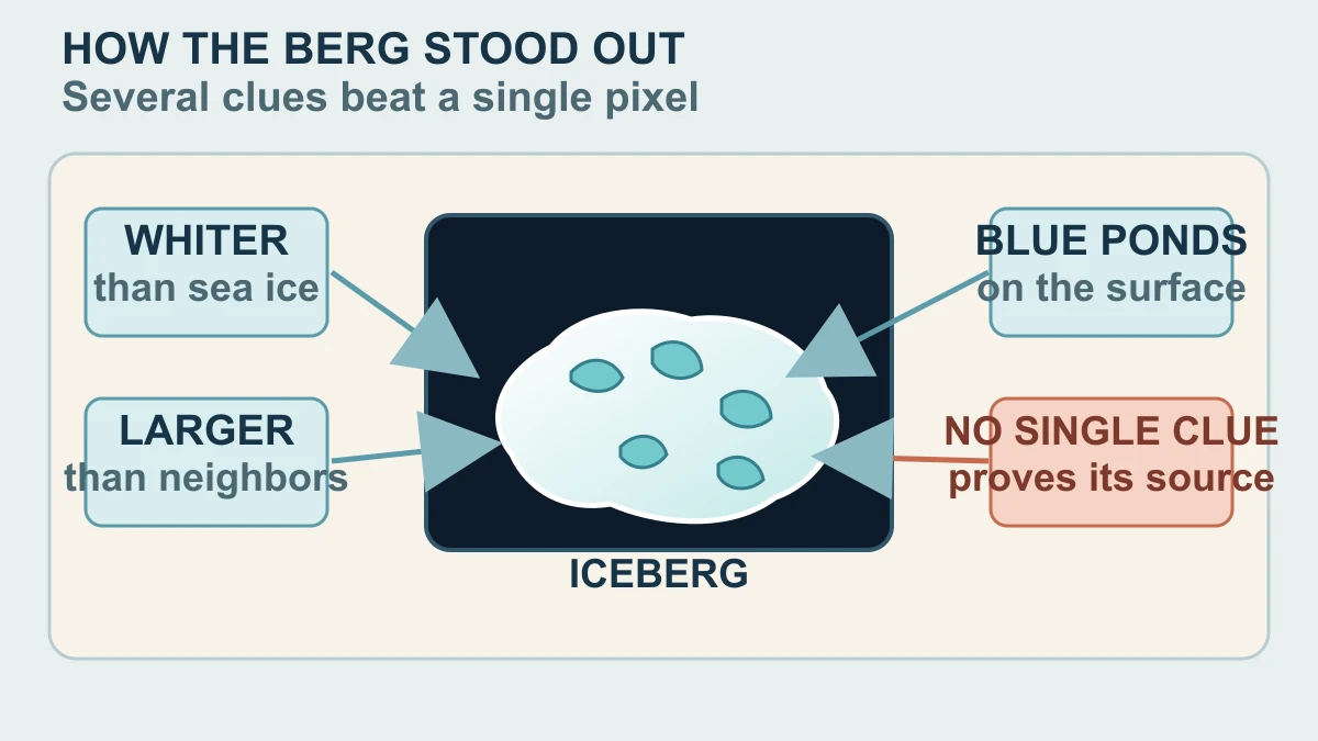
The June 12 scene does not identify the berg with a single label stamped onto the ice. NASA's experts used several visual clues together: the object was close to shore, noticeably whiter than the surrounding sea ice and much larger than its neighbours. NASA's estimate put it at roughly 17 square kilometres, or about seven square miles, in that image—large for Greenland even though Antarctic icebergs can be vastly bigger.
The surface supplied another clue. The bright white ice was dotted with light-blue meltwater ponds, and the network looked similar to the surface of remnant shelf ice in the likely source region. That resemblance led glaciologist Christopher Shuman to think the berg may have broken from the remnant ice shelf rather than directly from Zachariæ Isstrøm. It is a reasoned comparison, not a photograph of the calving event.
Landsat makes this kind of comparison useful because it provides a calibrated, long-running record rather than one isolated tourist photograph. NASA describes the programme as a carefully calibrated science-quality archive, and the U.S. Geological Survey documents Landsat 9's Operational Land Imager and consistent bands. That consistency helps researchers compare scenes across dates, but it cannot remove clouds, ice clutter, changing illumination or the limits of a 30-metre observation.
The timing matters as much as the appearance. NASA reports that several look-alikes surrounded the berg in late May, especially where bright snow made individual pieces difficult to distinguish. Later, as the berg moved south and the nearby ice thinned, it became easier to follow. The identification is therefore a cumulative result: location, scale, colour, surface ponds and continuity across images reinforce one another.
Those clues answer a narrower question than the headline might suggest. They support the conclusion that the bright object was a large iceberg moving through the Denmark Strait, and they point toward a likely type of source ice. They do not provide a unique chemical fingerprint, a precise calving timestamp or proof that every blue pond formed in the same way.
The route is clearer than the exact birthplace
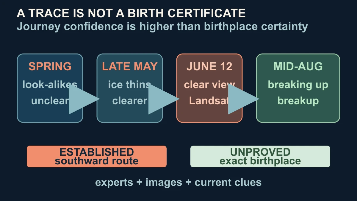
NASA places the likely source in Jøkelbugten, a bay in northeastern Greenland, but the exact origin within that bay remains uncertain. The berg could have broken from Zachariæ Isstrøm or from an adjacent remnant ice shelf. NASA's earlier satellite record shows that Zachariæ Isstrøm and the shelf once filled the bay before the glacier retreated rapidly, which makes the landscape relevant context without proving which piece produced this particular berg.
That distinction is common in remote sensing. A sequence of images can show an object becoming separated from its neighbours, appearing farther south and later breaking up. Experts can compare its shape and surface with ice that remains near a possible source. But if the earlier scene is crowded by look-alikes, the exact starting piece may never be recoverable from the public images alone. A likely bay is not a coordinate.
By mid-August, NASA reported the berg drifting south on the Greenland Coastal Current and expected it to gradually disintegrate. Recent imagery suggested that breakup was underway. That observation makes the route's endpoint more bounded, but it still does not turn the story into a future forecast. The article cannot infer where every fragment went, how much mass disappeared each day or whether another iceberg will follow the same path.
The cleanest conclusion is therefore asymmetric: the southward journey is better established than the exact birthplace. Landsat scenes, current context and expert comparisons support a coherent explanation of how the berg moved and why it stood out. The original calving point, detailed path between observations and any general shipping implication remain outside what this public evidence proves.
Read that way, the hero image is more than a pretty patch of white and blue. It is one carefully dated observation inside a longer chain of comparisons. The meltwater ponds are clues, the current is a transport mechanism, and the uncertainty label is part of the result—not a gap to hide.
Sources and further reading
- NASA Earth Observatory — An Uncommon Drifter in the Denmark Strait ↗
- NASA Earth Observatory — Sea Ice in Denmark Strait ↗
- NASA Earth Observatory — Zachariæ Isstrøm Glacier, Greenland ↗
- NASA Science — Landsat mission ↗
- U.S. Geological Survey — Landsat 9 ↗
- NASA — Guidelines for using NASA Images and Media ↗
This article was written for Curiosity Desk. We do not copy other publishers or invent quotes. If a material error is found, we correct it openly.
Read the full standards →One answer should lead to a better question
Bring your curiosity to the group
Curious Minds is our public Facebook community for surprising science, strange history, Australian wildlife and everyday questions. No copied posts, no personal-friend invitations and no link dumping.
- Three self-contained discussion prompts each week
- Sourced answers and honest uncertainty
- Respectful conversation without spam