Ice made the parallel pattern
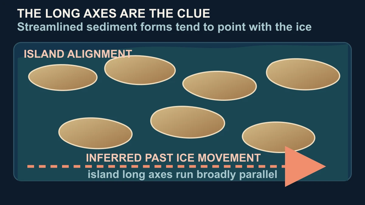
The quickest answer is that moving ice can streamline sediment into elongated landforms, so several landforms made under the same broad flow direction can end up pointing in parallel. NASA's Earth Observatory describes the Les Cheneaux Islands as glacially shaped and says many of their elongated forms are drumlins. The National Park Service supplies the independent mechanism: drumlins are sediment hills streamlined by glacier flow, and their long axes can help indicate the direction of that flow.
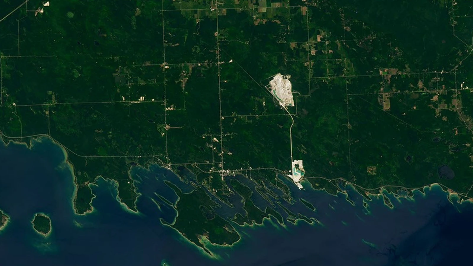
The modern clue is unusually easy to see from above. NASA's July 23, 2026 Landsat 9 image covers a roughly 12-mile stretch of Lake Huron shoreline where small islands outlined by tan beaches and bright shallow water repeat a similar diagonal orientation. The feature identifies the archipelago as 36 glacially shaped islands near Michigan's Upper Peninsula. The photograph-like view is contemporary; the pattern it reveals is the remnant of a much older landscape process.
A glacier does not need to leave a row of identical objects for alignment to be meaningful. Its movement can mould, abrade and deposit material across a broad area, while local rock, sediment and topography alter each individual landform. That is why the safest description is drumlin-like or consistent with streamlined glacial forms, not a claim that every visible island has the same shape or the same exact origin.
The parallel axes therefore provide an inference about direction, not a filmed record of the ice. They tell us that the landforms share a relationship with past ice movement, while the exact former margin, flow stages and timing require geological evidence beyond a single satellite scene. The visual reward is the pattern; the useful explanation is the physical process that can repeat it across a shoreline.
Why islands are separated by channels and coves
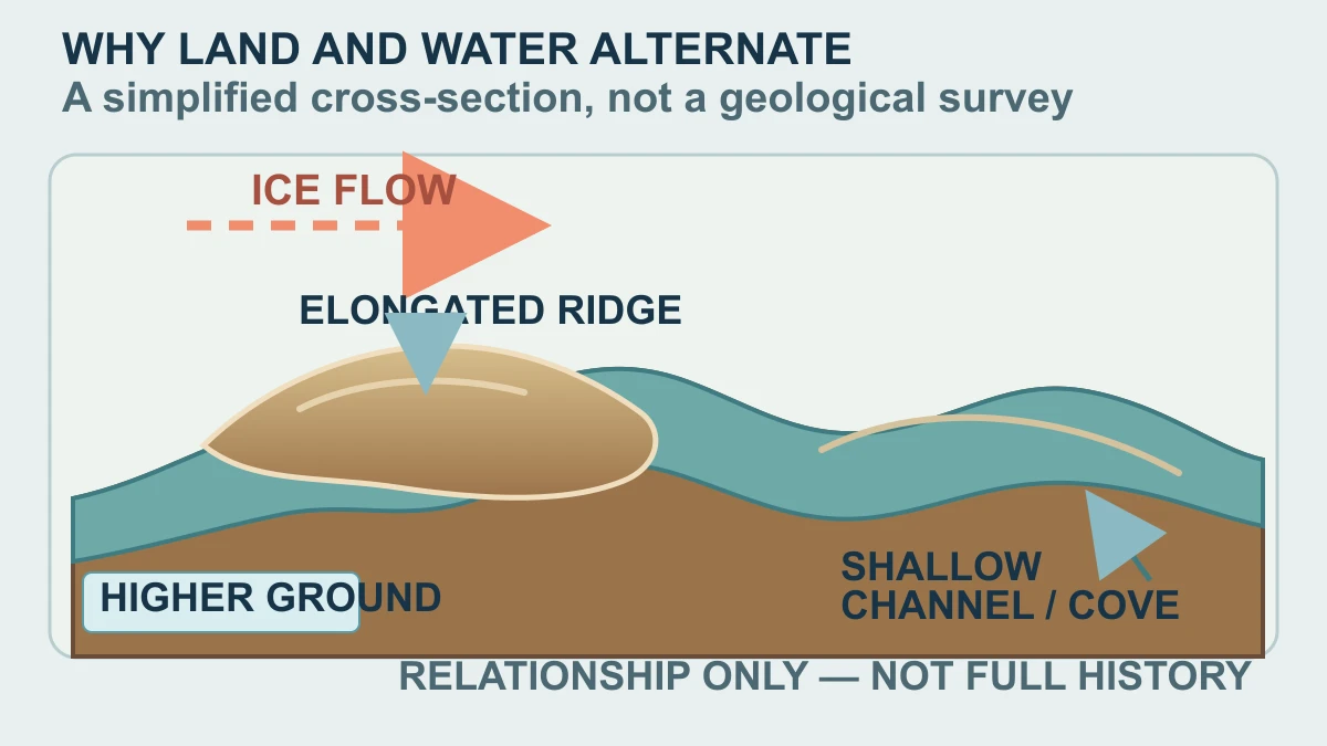
The island pattern is only half the picture. The same Landsat view shows bright, shallow water and sheltered channels threading between higher, forested or beach-edged ground. A useful simplified model is to picture elongated sediment ridges standing above lower spaces that later hold water. That model explains the relationship between parallel land and protected water, but it is an explanatory cross-section—not a claim that one diagram reconstructs every local meltwater or shoreline event.
NASA notes that the glacial topography helps create relatively protected waters around the islands, and that the name Les Cheneaux roughly translates from French as 'the channels.' Coves and narrow passages are not decorative gaps in the image: they are part of why the archipelago has a different water character from the open expanse of Lake Huron. The landscape's human use follows that physical shelter, with paddling, fishing and boat-building tied to the quieter water.
Water colour adds another layer of evidence. Shallow margins can glow tan, turquoise or green where beaches, submerged ground and depth change the reflected light. Those tones help a satellite reader see the coastline and the gaps between islands, but they are not a geological clock. A bright shallow-water edge can show where water meets land today; it cannot by itself date the sediment mound or identify the precise moment a channel formed.
The bedrock underneath the story is older still. NASA identifies the area's bedrock as dolomite, a form of limestone deposited more than 400 million years ago in a shallow tropical sea. That fact belongs to a different time scale from the Wisconsin Ice Age glacial shaping and the July 2026 Landsat observation. Keeping those layers separate prevents a common mistake: treating every visible colour and every piece of geology as if one recent image recorded one continuous event.
So the channels and coves are best read as present-day water occupying and outlining a glacially shaped coastal landscape, with local details left open. The broad relationship is clear enough to explain; the complete sequence of ice, sediment, water level and shoreline change is not proved by the NASA image alone.
What the image shows—and what it cannot date
Landsat 9 is designed to make surface patterns comparable across time, not to act as a handheld camera hovering over one island. NASA lists 30-metre spatial resolution for its visible and infrared bands, a 16-day nominal temporal resolution and a partnership with the U.S. Geological Survey. Those specifications explain why the image can reveal an archipelago-scale arrangement while leaving small beaches, shallow-water boundaries and individual landform details below the scale of a single pixel or mixed across several surfaces.
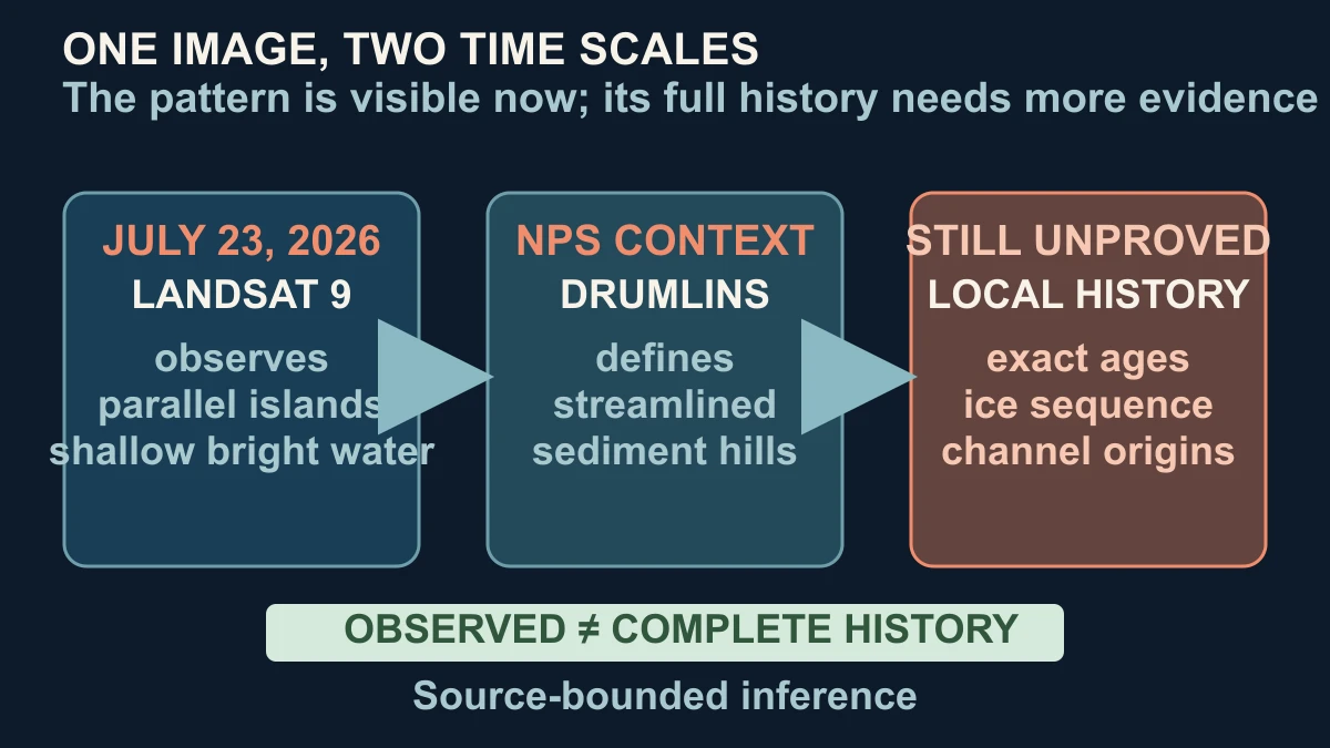
The July 2026 image establishes what the scene looked like on the acquisition date: 36 islands, elongated shapes, parallel orientation, bright shallow water and sheltered channels. It also supplies the documentary source for NASA's broad glacial interpretation. It does not establish the exact age of each island, prove that every island is a drumlin, or reveal the full ice-flow sequence simply because the pattern looks orderly from orbit.
That is why the NPS definition matters. It gives a separate landform mechanism that makes NASA's 'many are drumlins' explanation intelligible, while still leaving room for local variation. A careful reader can hold two statements at once: streamlined sediment hills often run in the direction of glacier flow, and this one current image cannot substitute for field mapping, sediment evidence or a complete regional geological reconstruction.
The strongest conclusion is therefore deliberately uneven. The parallel pattern is an observed visual fact, and its connection to glacially streamlined landforms is source-supported. The exact ages, the order in which ice retreated, the origin of each cove and the classification of every island remain questions for wider evidence. Treating that boundary as part of the answer makes the satellite view more useful, not less impressive.
Look again at the hero and the mechanism becomes visible: the islands are not arranged like a decorative row, and the water is not merely empty background. Their alignment preserves a directional clue from moving ice; the channels expose the spaces between higher ground; and the modern image lets us see both the pattern and the limit of what can honestly be inferred from it.
Sources and further reading
This article was written for Curiosity Desk. We do not copy other publishers or invent quotes. If a material error is found, we correct it openly.
Read the full standards →One answer should lead to a better question
Bring your curiosity to the group
Curious Minds is our public Facebook community for surprising science, strange history, Australian wildlife and everyday questions. No copied posts, no personal-friend invitations and no link dumping.
- Three self-contained discussion prompts each week
- Sourced answers and honest uncertainty
- Respectful conversation without spam