The first discovery is a site, not a finished story
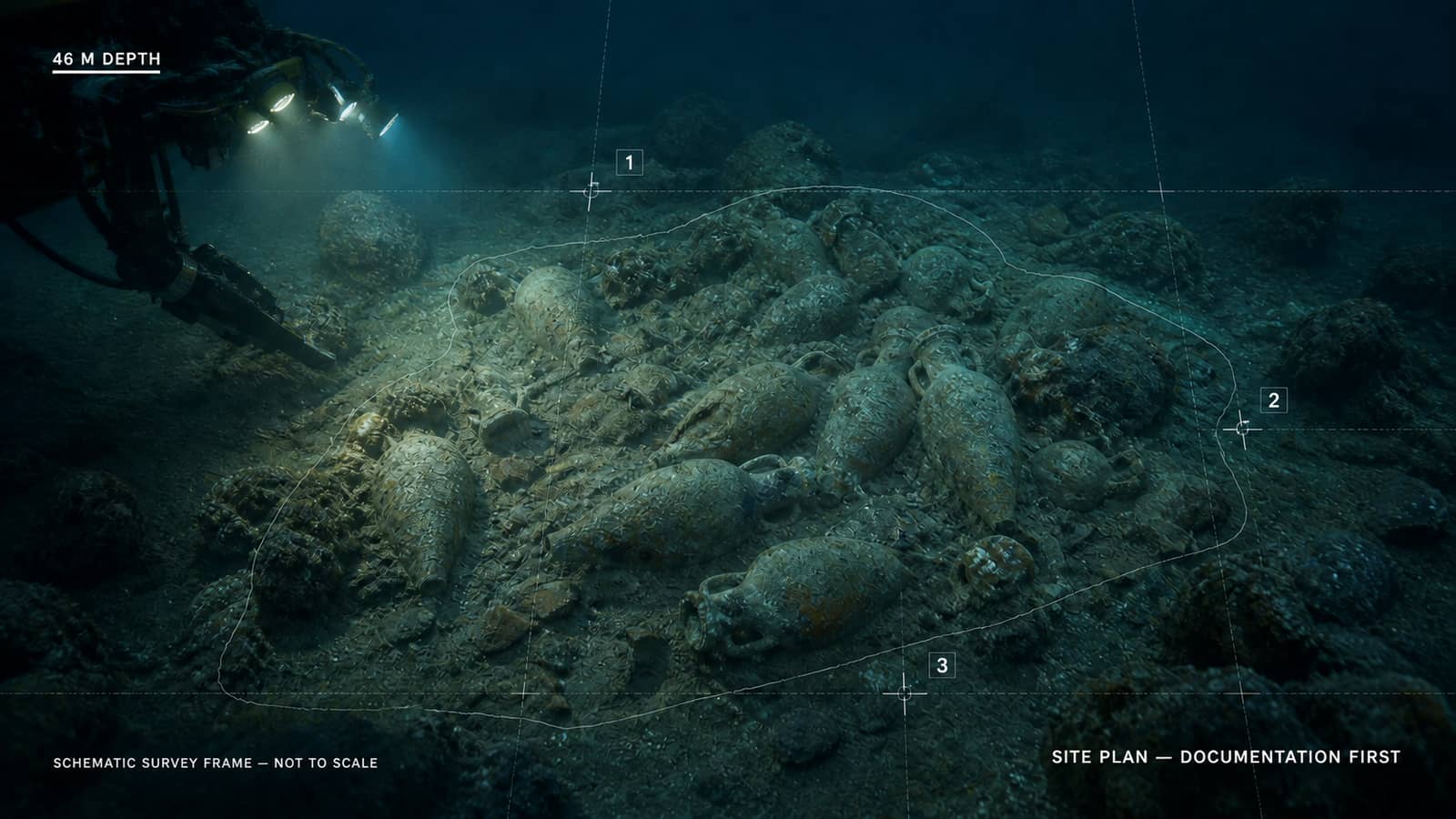
Italian cultural-heritage police announced that a Roman-period wreck had been located about three miles off Mazara del Vallo on Sicily's western coast, at a depth of 46 metres. The investigation followed information from private citizens and brought together the Carabinieri cultural-property unit in Palermo, Sicily's Superintendency of the Sea and specialist police divers from Messina, supported by a patrol boat from Trapani.
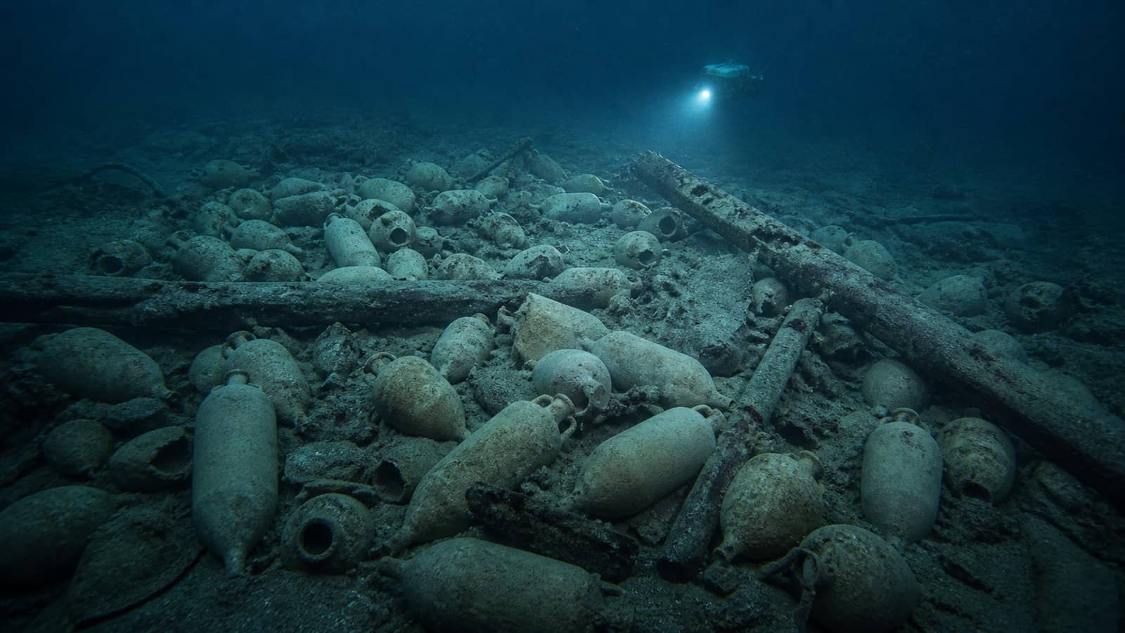
The official inspection describes hundreds of amphorae, mostly the form archaeologists call Dressel 1A, along with two lead anchor stocks and another lead structure. News reports have rounded the cargo to about 500 jars and describe a vessel roughly 21 metres long by six metres wide. The official dating is deliberately provisional: probably between the second and first centuries BCE. That is a research starting point, not a stamped year of sinking.
Underwater archaeology preserves relationships that recovery can destroy. A jar's value is not only its ceramic body but its position among neighbouring jars, the ship's surviving structure, anchors and sediment. For that reason, the next phase is documentation and protection. Archaeologists need a map of the site before individual objects are separated from the pattern that gives them meaning.
An amphora was packaging with a recognisable accent
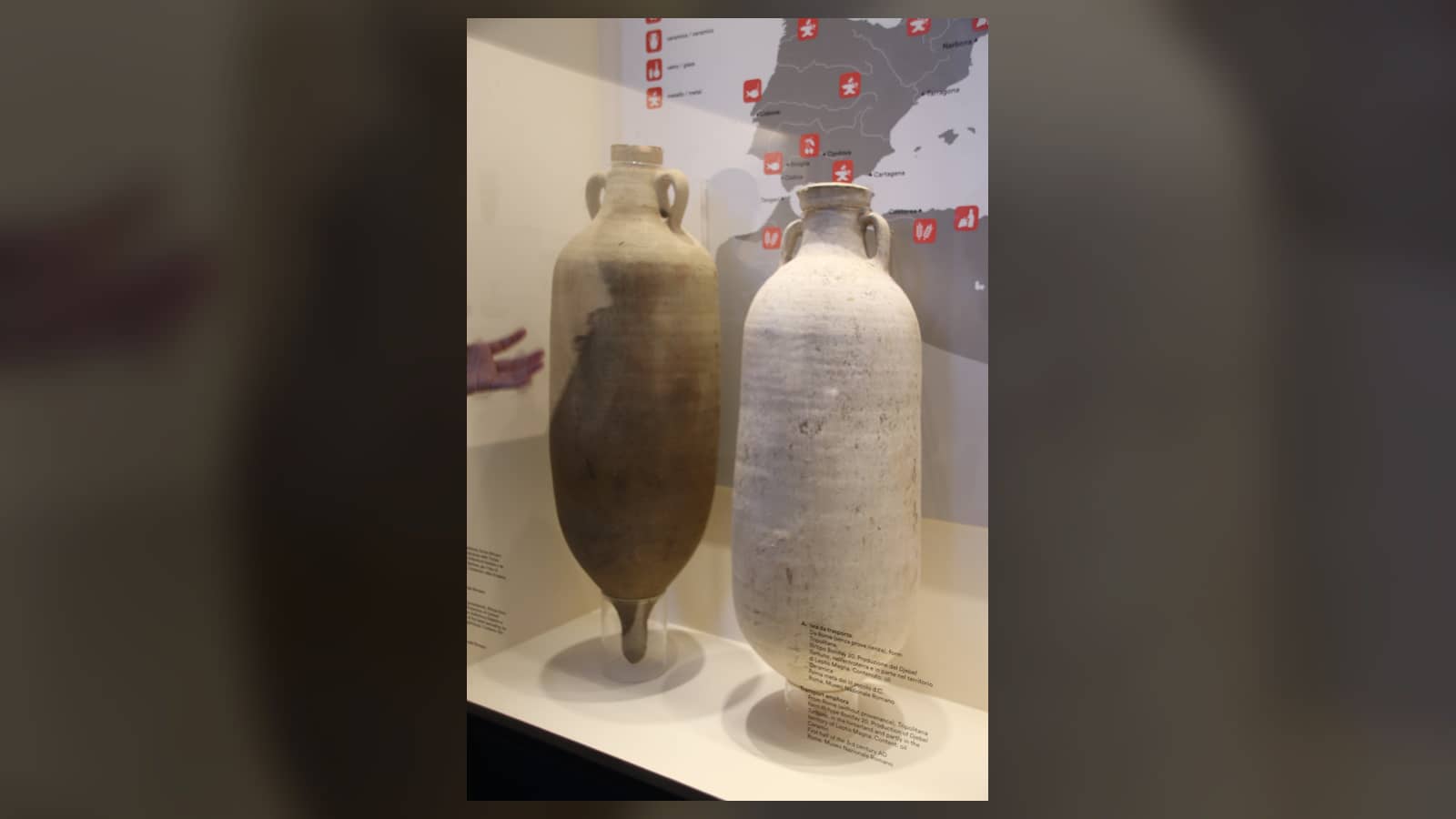
Amphorae were transport containers: strong ceramic jars with two handles, a narrow neck and a pointed or shaped base that could be packed closely in a ship. Different production regions and periods favoured different proportions, rims, handles and clay fabrics. The name Dressel comes from a modern classification system, not a label used by the ship's crew. Type 1A is associated with the late Roman Republic and is widely linked with Italian wine transport.
Shape narrows possibilities, but responsible identification uses more than silhouette. Specialists can compare clay composition, manufacturing marks, residues and parallels from dated sites. A stamp may name a workshop or official; residue can support what a container held; mineral analysis can connect clay to a production zone. No single clue automatically proves a port of origin or destination, but several independent clues can converge.
A cargo dominated by one form is especially informative. It suggests planned commercial loading rather than a random collection of household vessels. If the jars share origin and date, the group can identify a commodity movement at a particular moment. The ship becomes a frozen transaction: containers were made, filled, assembled, loaded and sent along a route that ended on the seabed.
The arrangement may reveal the voyage that never finished
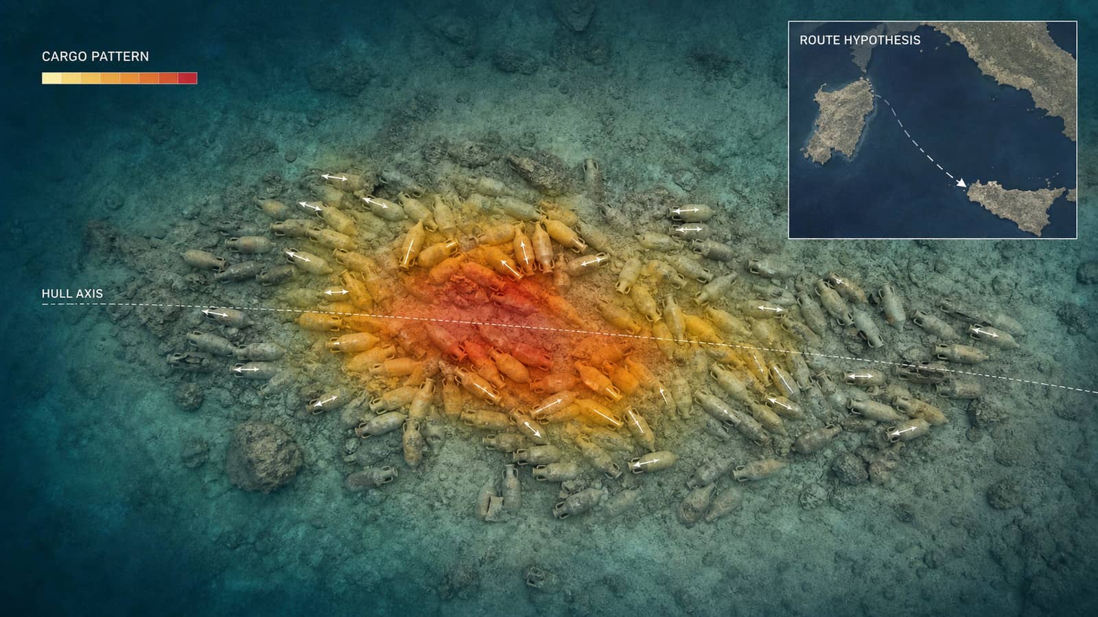
Researchers will want to know whether the amphorae remain in loading rows, shifted together as the ship sank or scattered later by currents and fishing activity. A tight concentration can suggest the vessel's orientation even where timber is buried. Gaps and breakage patterns may show how the hull failed. Anchors add another clue: their location can indicate whether they were stowed, deployed or displaced after wrecking.
The broader question is network reconstruction. Sicily sits amid routes connecting the Italian peninsula, North Africa, Iberia, Greece and the eastern Mediterranean. Identifying where the cargo began and where comparable jars accumulated can place this ship within those connections. The route will not be read from a single jar like an address label; it will be inferred from container type, clay, contents, site location and other known wrecks and ports.
That is why '500 amphorae found' is only the opening sentence. The count makes the discovery spectacular, but the pattern makes it historical evidence. If careful mapping preserves that pattern, the wreck may reveal how merchants standardised containers, concentrated cargo and connected producers with distant consumers more than two thousand years ago—one interrupted delivery reconstructed from the seabed outward.
Several tempting conclusions must wait. The preliminary date does not identify a named merchant, the likely wine containers do not yet prove the contents of every jar, and the wreck's position near Sicily does not reveal its destination by itself. Future photogrammetry, sampling and comparison may narrow those questions. Good archaeology keeps that uncertainty visible because every new measurement should be able to change the route reconstruction rather than merely decorate a story decided on discovery day.
A digital site model can preserve much of that spatial evidence before any selective recovery. Overlapping photographs allow researchers to build a measurable three-dimensional record of jar positions and seabed shape. Later dives can be compared with the baseline to detect movement or damage. The model does not replace excavation, but it lets questions be tested against the whole cargo rather than against only the objects that reach a laboratory.
Sources and further reading
This article was written for Curiosity Desk. We do not copy other publishers or invent quotes. If a material error is found, we correct it openly.
Read the full standards →One answer should lead to a better question
Bring your curiosity to the group
Curious Minds is our public Facebook community for surprising science, strange history, Australian wildlife and everyday questions. No copied posts, no personal-friend invitations and no link dumping.
- Three self-contained discussion prompts each week
- Sourced answers and honest uncertainty
- Respectful conversation without spam