The rover's route gained a measured kilometre
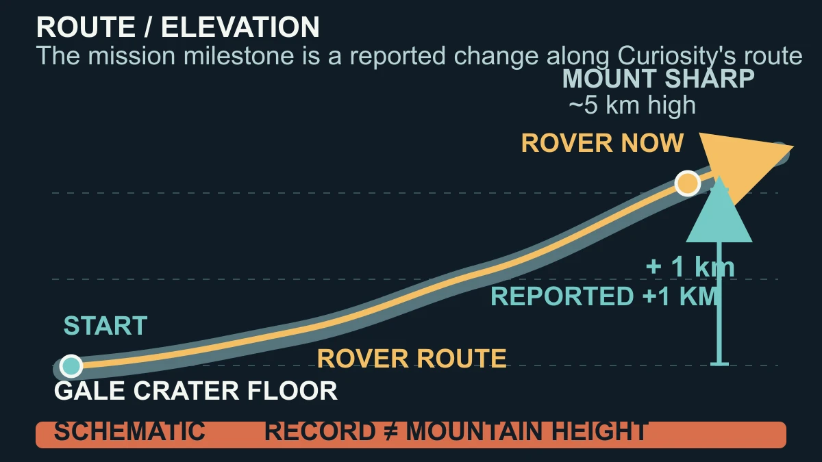
NASA reported that Curiosity marked an elevation gain of 1 kilometre on Aug. 26, 2026, during its journey from Gale Crater up the slope of Mount Sharp. The safest reading is a mission milestone about the rover's changing elevation along its route. It is not a claim that a camera in the new photograph measured a vertical kilometre, and it is not a statement that Curiosity has climbed to the top of the mountain.
That distinction matters because Mount Sharp is much larger than the milestone. NASA describes the mountain as roughly 3 miles, or 5 kilometres, tall, with Curiosity climbing its slope since 2014. A previous NASA panorama from 2017 gives two different route numbers side by side: Curiosity had gained 327 metres in elevation but driven 17.63 kilometres from its landing site. The horizontal distance and the elevation change were related, not interchangeable.
The word climbed is useful shorthand for a robotic rover following a route that rises across the interior of Gale Crater. It should not be read as a human-like, continuous ascent of one kilometre up a single face. NASA's current report establishes the completed elevation milestone, but it does not publish a full coordinate table or the processing algorithm on that page. This package therefore keeps the measurement claim at the level NASA reports and does not invent a more precise reconstruction.
How terrain, rover position and Mastcam imagery establish the milestone
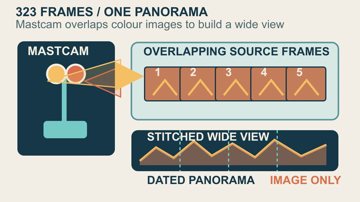
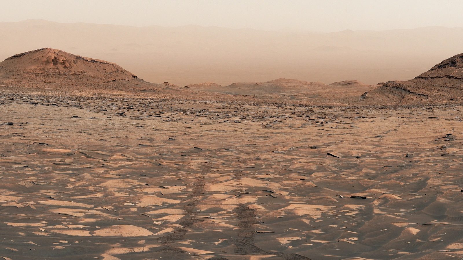
The accompanying view was captured on Aug. 1 and 2, 2026, the mission's 4,972nd and 4,973rd Martian days. NASA says it looks back from Curiosity's current position through a broad valley nicknamed Valle Grande toward the floor of Gale Crater. The image is one panorama made from 323 individual Mastcam images, with its colour adjusted to resemble how the scene would look to human eyes on Earth.
Mastcam is a pair of colour cameras mounted about 2 metres above the ground, with about 25 centimetres between them. NASA's instrument page describes a wide-angle left eye and a telephoto right eye, each serving panoramic terrain imaging as well as driving and sampling operations. A wide scene is assembled from many frames that overlap in a planned sequence; the frame count tells us how the panorama was built, not how far the rover moved vertically.
The older panorama makes that separation easier to see. It combined 16 side-by-side images from Mastcam's wider-angle camera and was taken at a point where Curiosity had gained 327 metres but driven 17.63 kilometres. The new 323-frame view is a record of a later landscape and a later camera operation. The mission's elevation milestone and the panorama support each other as context, but they are different evidence streams with different jobs.
What the panorama shows and cannot prove about Mars
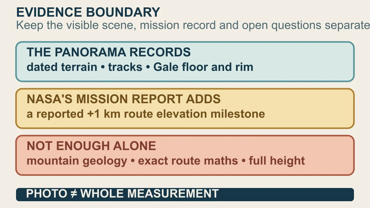
NASA's Figure A crop shows Curiosity's tracks disappearing into the distance, with the floor and northern rim of Gale Crater visible through the dusty atmosphere. That is a strong visual answer to where the rover is looking from: a machine on the side of Mount Sharp, looking back across terrain it has travelled through. The image is documentary evidence of the scene and of the panorama operation, with the NASA/JPL-Caltech/MSSS credit retained.
The picture cannot, by itself, establish the exact route calculation behind the one-kilometre figure. Perspective makes distant slopes look flatter or steeper, tracks can fade or disappear, and a panorama joins views taken across a sequence of camera frames. Nor is a colour landscape panorama a chemical or mineralogical assay. NASA lists separate instruments for analysing elements, minerals, textures and other properties, so a photograph should not be promoted into a geology result it was not designed to provide.
The useful conclusion is therefore precise rather than spectacular. Curiosity has reached a reported 1-kilometre elevation gain during its long route up Mount Sharp, and its 323-image Mastcam panorama shows the terrain from that current position. The scene helps readers picture the milestone, while the mission and instrument records keep the measurement method and geological interpretation honest. If NASA later supplies a fuller route calculation or a material correction, the source trail and corrections route are the places to update the answer.
Sources and further reading
This article was written for Curiosity Desk. We do not copy other publishers or invent quotes. If a material error is found, we correct it openly.
Read the full standards →One answer should lead to a better question
Bring your curiosity to the group
Curious Minds is our public Facebook community for surprising science, strange history, Australian wildlife and everyday questions. No copied posts, no personal-friend invitations and no link dumping.
- Three self-contained discussion prompts each week
- Sourced answers and honest uncertainty
- Respectful conversation without spam