Immediate answer
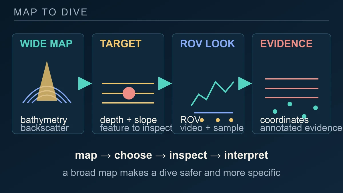
Robots do not map a deep-sea habitat by themselves. The reliable approach is a relay between a ship's broad acoustic survey and a vehicle's close observation. Multibeam sonar first measures the shape of the seafloor and the strength of returning signals. Those maps help a team choose a feature, slope or plain worth inspecting. An ROV can then descend with cameras and other instruments, keep its position tied to the seafloor and record what is actually there.
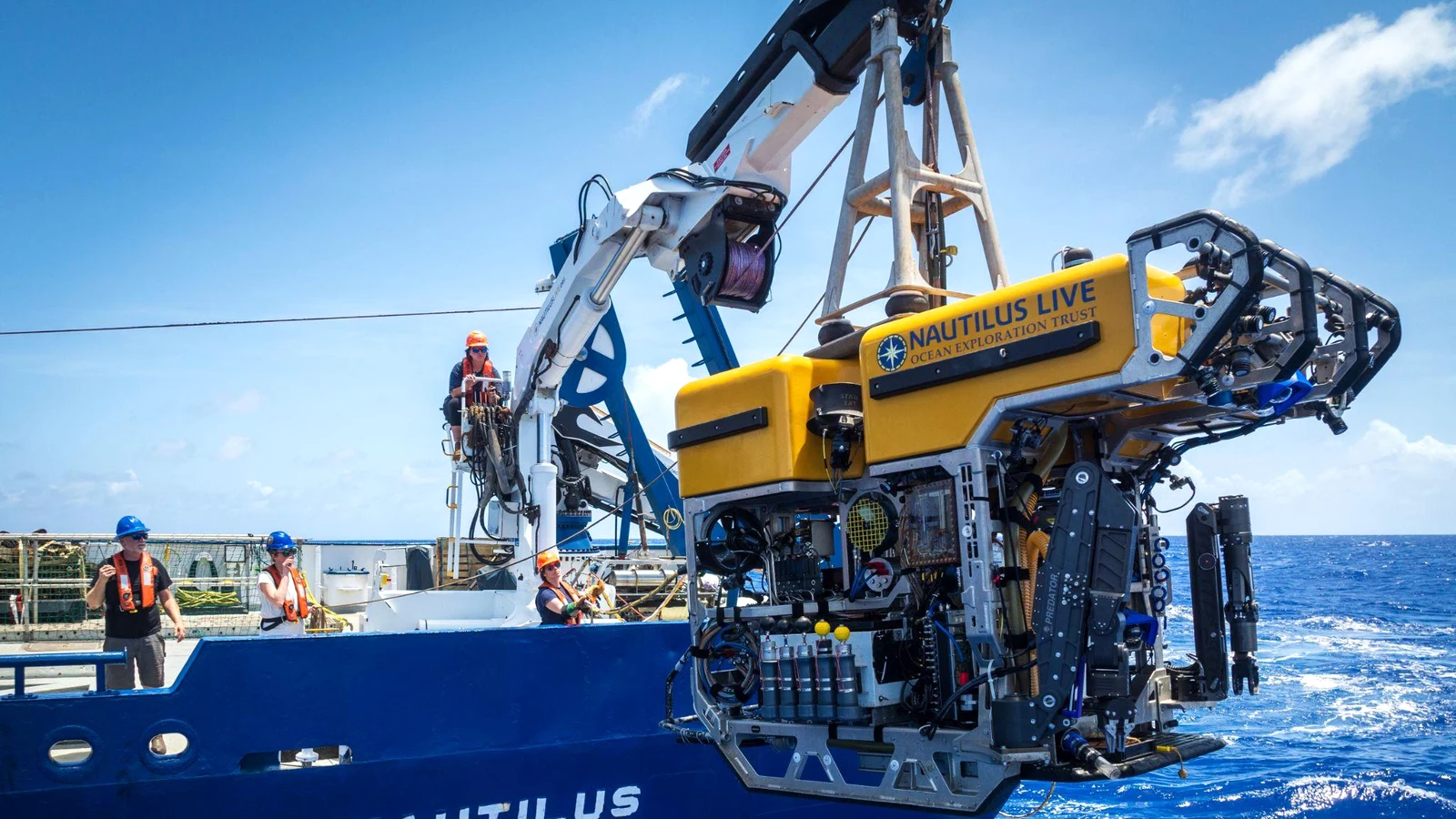
That is the logic behind the 2026 Exploration of Wake Island's Deep Sea. NOAA's calendar lists a 20 August–18 September expedition on E/V Nautilus in the U.S. Exclusive Economic Zone around Wake Island, focused on abyssal plain habitats, unexplored seamounts and potential maritime-heritage sites connected with the Battle of Wake Island. Live video from the ROV Hercules is planned for public viewing.
The important wording is 'focused on' and 'planned.' The expedition page establishes the mission's target areas and tools. It does not, before published observations are available, establish that a new habitat, species or wreck has been found. The map-to-dive method makes discovery possible; it does not make the result known in advance.
How sonar, remotely operated vehicles and in-situ observation work together
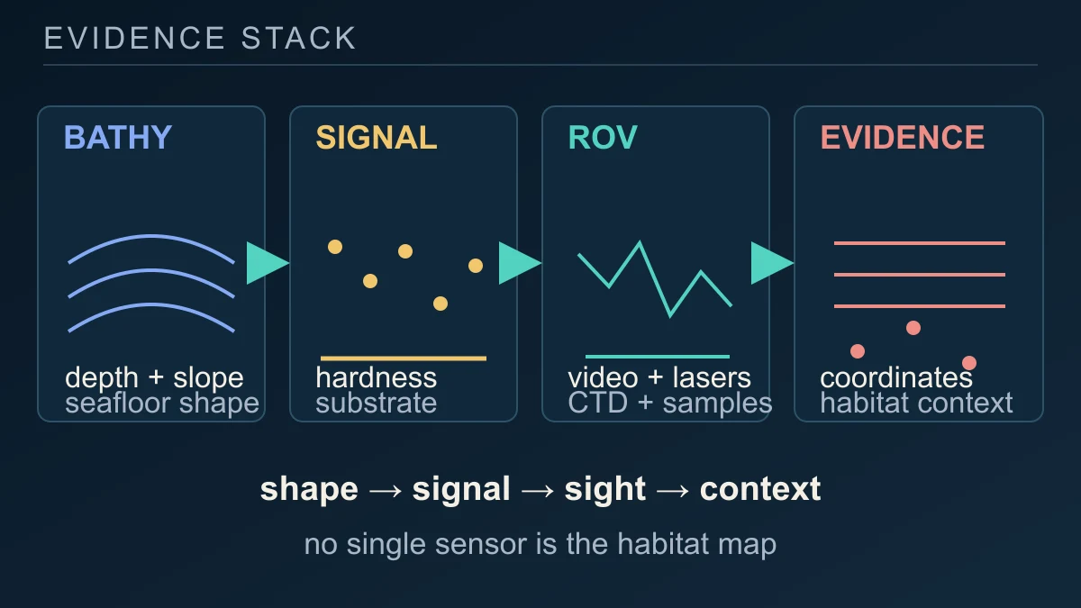
A multibeam sonar sends many sound beams in a fan-shaped pattern beneath and beside the ship. The time taken for an echo to return, combined with measurements of sound speed in the water, produces bathymetry: a map of seafloor depth. The intensity of the echo adds backscatter information. Harder rock or coral generally returns more sound than soft sediment, while water-column backscatter can reveal objects, biological layers or bubble plumes.
The broad survey is efficient, but depth reduces the detail available from the ship. NOAA's method record explains that close-to-seafloor sonar on a remotely operated or autonomous vehicle can produce higher-resolution information. Mapping teams process the incoming data, check its continuity and use depth, slope and features such as seamounts, seeps or wrecks to plan a safer and more useful ROV transect.
That first map is a decision tool, not a finished biological inventory. Backscatter can suggest a harder or softer bottom and can flag a plume or object, but it does not identify every organism living there. NOAA describes mapping watchstanders checking incoming points, troubleshooting instruments and producing daily map products so the next dive is based on a consistent record rather than an isolated acoustic impression.
The ROV adds a different kind of evidence. Cameras show the sediment, rocks, animals or structures directly; navigation instruments attach observations to position; sensors can record environmental conditions; and manipulators or samplers can collect biological or geological material for later study. NOAA describes time-stamped video annotations as records that can be plotted with latitude and longitude. The result is not one magical habitat sensor but a stack: shape, acoustic signal, visual evidence, environmental context and location all constrain the interpretation.
What an expedition plan can establish before data are published
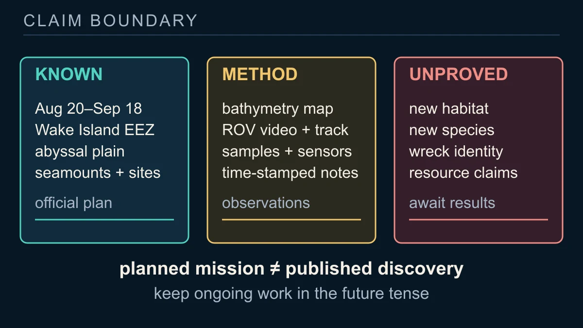
Before the Wake expedition releases new observations, the defensible claims are about its design and purpose. NOAA's current programme identifies the location, dates, target types and public ROV-video plan. The E/V Nautilus field-season record identifies multibeam sonar, the Hercules family of ROVs and the autonomous vehicle Sentry as primary technologies for the wider Pacific programme. Those records establish capability and intent, not a completed biological inventory.
If the mission publishes the relevant data, the evidence can become more specific: bathymetry can show the seafloor's shape; backscatter can provide substrate and water-column clues; ROV imagery can document organisms or geological and maritime-heritage features; tracks and annotations can put those observations on a map; samples can support later geological or biological analysis. Even then, a single video frame is not automatically a species identification or a complete habitat assessment.
The time boundary matters because the current page is a live expedition listing, not a final cruise report. A target can be missed, revised or revisited; a promising image can need taxonomic or archaeological follow-up; and a map can expose a feature without explaining how it formed. Reporting the plan as a plan preserves the reader's ability to distinguish what NOAA has scheduled, what the instruments may observe and what later evidence will establish.
So the honest answer stays conditional while the expedition is underway. Robots help map unexplored deep-sea habitats by pairing wide-area acoustic context with close, georeferenced observation and in-situ measurements. Around Wake Island, the mission can produce a much sharper baseline for future science and management. It cannot be used to report a discovery that the official record has not yet published.
Sources and further reading
This article was written for Curiosity Desk. We do not copy other publishers or invent quotes. If a material error is found, we correct it openly.
Read the full standards →One answer should lead to a better question
Bring your curiosity to the group
Curious Minds is our public Facebook community for surprising science, strange history, Australian wildlife and everyday questions. No copied posts, no personal-friend invitations and no link dumping.
- Three self-contained discussion prompts each week
- Sourced answers and honest uncertainty
- Respectful conversation without spam