The lake that became a landscape
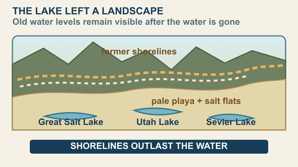
The short answer is that Lake Bonneville did not simply disappear; it left a set of raised shorelines, pale lakebed surfaces and smaller lakes that can still be read from above. Water once covered a huge part of the Great Basin, and when the level fell, the boundary between wet and dry became a geological record rather than a vanishing point.
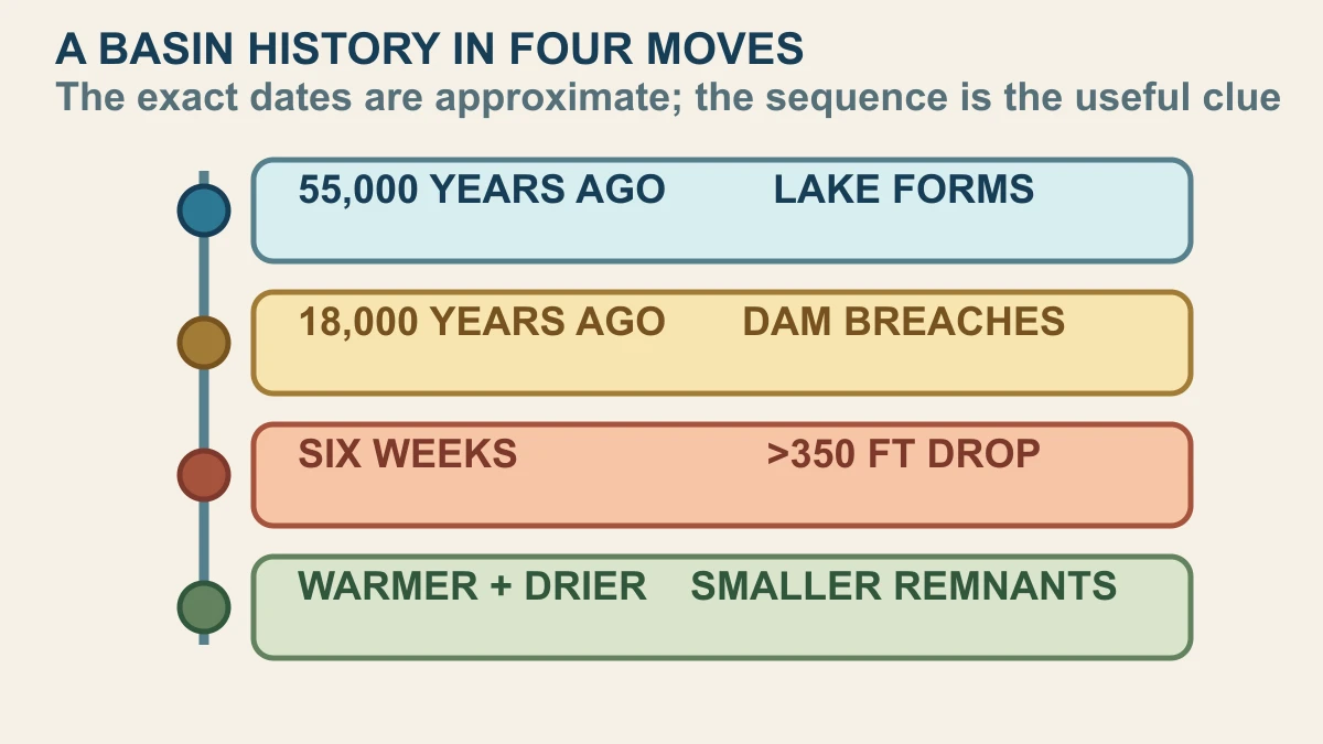
NASA's current Earth Observatory report describes Lake Bonneville as an ancient lake that was once nearly as large as Lake Michigan, spreading across western Utah and parts of Nevada and Idaho. It began forming around 55,000 years ago. Around 18,000 years ago, a breach at Red Rock Pass released water rapidly: NASA says the level dropped by more than 350 feet, or about 105 metres, over six weeks.
After that flood, a warmer and drier climate helped shrink the remaining water. The modern Great Salt Lake, Utah Lake and Sevier Lake are remnants of the much larger system, while the old shoreline rings sit higher on the surrounding basin. The U.S. Geological Survey report supplies the geologic mapping context; NASA's new image supplies a current visual scene in which that older history is still legible.
How satellite images preserve old shorelines
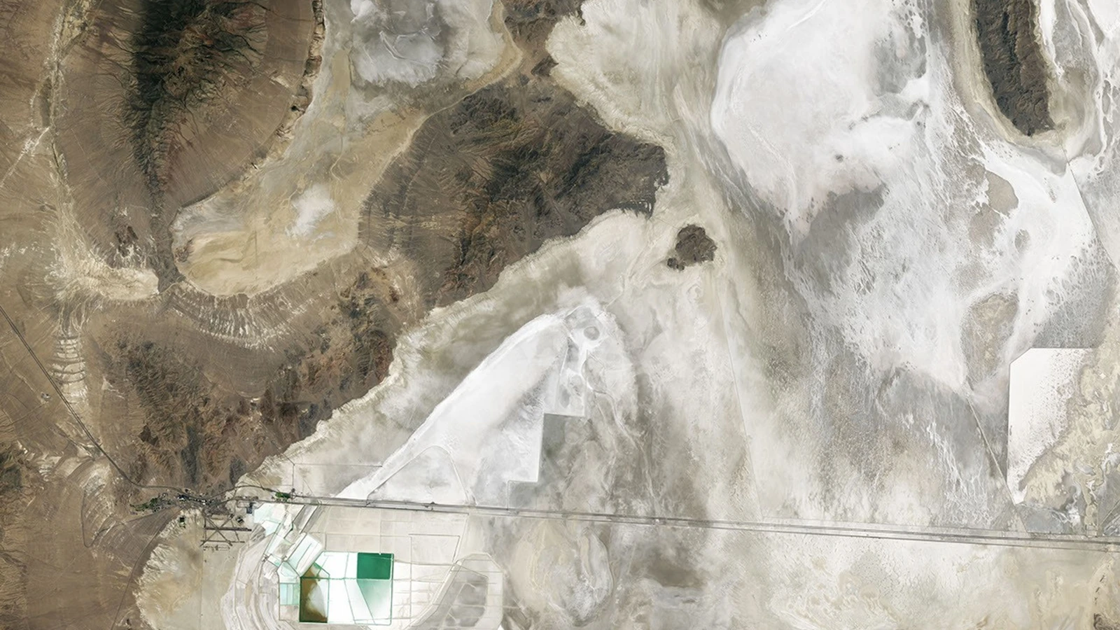
A satellite does not photograph the ancient lake itself. Landsat records the surface that exists now: the pale playa, salt flats, darker mountain blocks and the curved traces where wave action and changing water levels shaped the basin edge. Those traces are useful because geology can preserve a former water boundary long after the water, shoreline vegetation and local climate have changed.
NASA's 4 June 2026 Landsat 8 OLI scene focuses on Crater Island, the Silver Island Mountains and the bright floor of the former lake. The image is an observation of present-day land, not a reconstruction of a single Ice Age day. Reading it well means combining the satellite colours and shapes with elevation, mapped deposits, known basin history and field observations rather than treating every bright patch as a simple label.
The useful trick is comparison across evidence types. A broad tonal boundary in an image becomes more informative when it follows a mapped contour, matches a known shoreline elevation or recurs around the basin in a shape that water could plausibly have made. That does not remove uncertainty, but it turns a striking pattern into a testable interpretation rather than a visual guess.
That is why the chronology matters. A high shoreline can be evidence of a former lake level; a salt flat can show where water and evaporation concentrated minerals; and a smaller modern lake can mark part of the old basin that still holds water. The visual answer becomes stronger when each interpretation is tied to a source and when the image's limits are stated: Landsat shows patterns, while geologic and elevation evidence help explain what those patterns mean.
Why the basin helps test planetary instruments
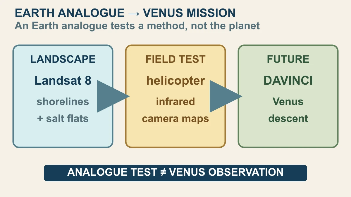
The Lake Bonneville scene also appears in a second kind of story: how engineers test ways of seeing difficult planetary terrain. NASA reports that a DAVINCI camera system was tested from a helicopter in Utah on 24 June 2026. The team collected infrared images and many additional images to build three-dimensional maps, and NASA says the results were consistent with the area's geology. That is an Earth field test, not a Venus observation.
An Earth analogue is valuable because it lets a team check a method against a place whose rocks, elevations and surface history can be studied independently. If a camera-derived map agrees with known geology, that gives engineers evidence about the workflow, calibration and interpretation. It does not prove that the same method will work unchanged through Venus's atmosphere, lighting, chemistry, temperature or descent conditions.
DAVINCI is planned as a Venus mission, so the honest connection runs from method to future test: a documented Earth landscape helps researchers practise and evaluate an imaging approach before a spacecraft uses its instruments during descent. The Landsat image, the USGS geologic record and the Utah helicopter test each establish different things. Together they show how a vanished lake can remain a readable landscape and a useful analogue without becoming evidence from another planet.
Sources and further reading
This article was written for Curiosity Desk. We do not copy other publishers or invent quotes. If a material error is found, we correct it openly.
Read the full standards →One answer should lead to a better question
Bring your curiosity to the group
Curious Minds is our public Facebook community for surprising science, strange history, Australian wildlife and everyday questions. No copied posts, no personal-friend invitations and no link dumping.
- Three self-contained discussion prompts each week
- Sourced answers and honest uncertainty
- Respectful conversation without spam