Satellites extend a fragmented wildlife record
The short answer is that Landsat does not count individual emperor penguins from orbit. Instead, researchers use repeat satellite scenes to locate colonies, follow the ice surfaces where birds gather and identify the brown guano stains that can remain visible on the ice. That turns an inaccessible coastline into a dated record of presence and place, not a photograph of every bird or a complete population census.
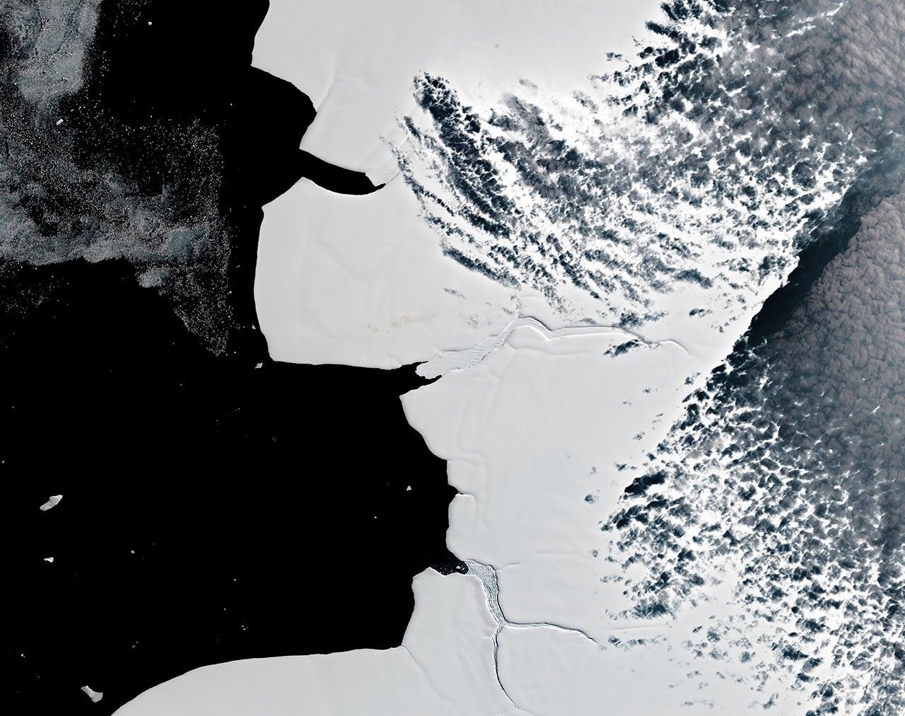
The habitat clue is fast ice: sea ice attached to the shoreline or ocean bottom rather than drifting freely with wind and currents. Emperor penguins rely on stable fast ice to breed, raise chicks and molt. When an ice shelf calves, fast ice breaks out early or a colony finds better shelter elsewhere, the surface around the breeding site can change. A satellite record can revisit that setting even when field access is difficult.
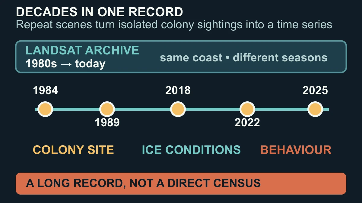
The value is historical as much as visual. NASA's current report describes studies that used decades of NASA-USGS Landsat observations, and one open study confirmed that 18 of the 66 known colonies were present in images older than their first published records by an average of 17 years. In other words, old images can move the beginning of a colony record backward. They do not tell us that the same number of adults was present in every scene.
How repeated Landsat scenes turn sea-ice patterns into evidence
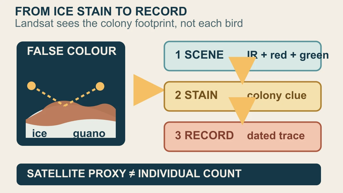
The signal often becomes easier to see when researchers combine infrared, red and green observations into a false-color image. NASA Earth Observatory describes guano stains on fast ice that can be distinguished from the surrounding snow and ice in Landsat scenes. The scene is still an image of the surface: the stain is a proxy for a colony gathered there, not a resolved line of individual penguins walking across the frame.
Repeat observations add the time dimension. A 1989 scene and a similar 2025 scene can show whether a colony trace is still appearing at a site, while other dated scenes can show a trail, a split or a move to an iceberg, an embayment or an ice shelf. Landsat's long, calibrated archive is what makes this comparison possible. A separate 2026 study analysed Landsat 4–9 together with ASTER and Sentinel-2 imagery from 1984 through 2024 to record colony locations, ice events and the surfaces birds used.
The three-colony study illustrates why the sequence matters. After major calving events or early fast-ice breakouts, the Astrid, Mertz and SANAE colonies sometimes shifted locations, then in later years returned near their former sites. That is evidence of behavioural flexibility under changing local conditions. It is not proof that every colony can make the same move, that a move was caused by one climate variable, or that a short sequence predicts the species' future.
What imagery can and cannot say about penguin populations
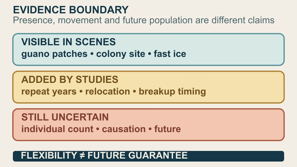
A guano patch is useful because it can mark where a colony gathered, and changes in its area can be compared with other observations. The historical remote-sensing study found that guano area at the Cape Washington colony was correlated with observed chick counts from ground surveys, while also finding substantial year-to-year variation and no strong evidence for a consistent long-term directional trend there. A proxy can be informative without being a direct head count.
There is a second scale of evidence. A 2024 global study combined high-resolution satellite imagery with validation surveys and Bayesian modelling to estimate population indices over a recent 10-year period. That is a modelled estimate with uncertainty, not the same thing as reading a total from one Landsat scene. Keeping those methods separate prevents a reader from treating a colony stain, a validated index and a forecast as interchangeable numbers.
The word adapting needs the same care. The observations support examples of emperor penguins relocating, returning and sometimes using alternative ice surfaces. NASA's report describes that as flexibility and notes that one bad breeding year does not automatically mean a colony has ended. But behavioural flexibility alone cannot guarantee survival under continued sea-ice loss, and these satellite records do not by themselves prove genetic adaptation, causation or a secure future population. They show where to look, what changed and which questions still need evidence.
Sources and further reading
- NASA Earth Observatory — A Changing World for Emperor Penguins ↗
- Bielinis et al. — Historical remote sensing highlights long-term persistence of Emperor Penguin colonies ↗
- Macdonald et al. — Response of emperor penguins to 40 years of changing ice conditions ↗
- LaRue et al. — Advances in remote sensing of emperor penguins ↗
- NASA Science — Landsat mission overview ↗
- National Snow and Ice Data Center — Fast ice glossary ↗
- NASA — Guidelines for using NASA Images and Media ↗
This article was written for Curiosity Desk. We do not copy other publishers or invent quotes. If a material error is found, we correct it openly.
Read the full standards →One answer should lead to a better question
Bring your curiosity to the group
Curious Minds is our public Facebook community for surprising science, strange history, Australian wildlife and everyday questions. No copied posts, no personal-friend invitations and no link dumping.
- Three self-contained discussion prompts each week
- Sourced answers and honest uncertainty
- Respectful conversation without spam