A star tracker starts with angles, not a full orbit
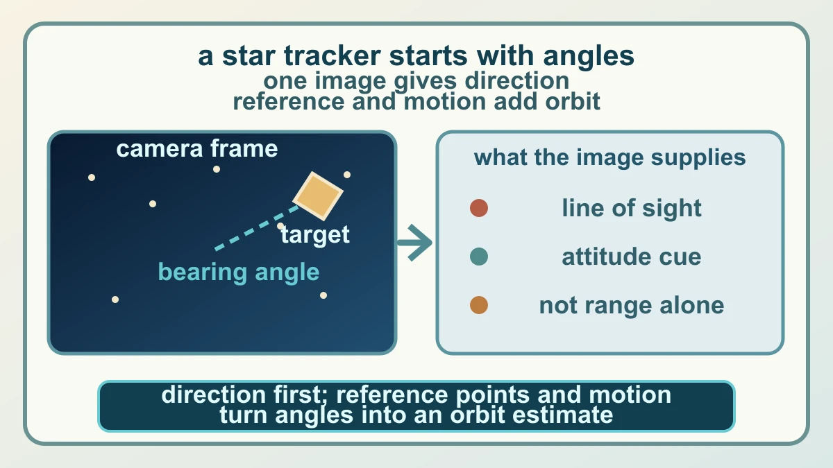
A star tracker is often described as a spacecraft's way of finding its bearings, and that is a useful starting point. Its camera sees a field of bright points and measures directions to objects in the field of view. A direction is not the same thing as a complete position. If the spacecraft knows only that an object lies along a line of sight, it still needs reference geometry, motion or another observation to work out where it is along that line.
That distinction is the key to reading NASA's FALCON result. Starling's onboard star-tracker cameras are standard instruments for identifying bright objects and informing a spacecraft's orientation and position. In the FALCON experiment, the cameras did more than recognise the background stars: they observed other spacecraft and pieces of orbital debris. Those objects became useful only after the system could connect an observed point of light to a known object in a catalogue.
The first step is therefore a measurement, not a navigation answer. The camera supplies a bearing angle and an attitude cue; the rest of the system must decide what was seen and combine that observation with a model of motion. This is why optical navigation can be useful when a conventional signal is unavailable without being magic. The method trades a transmitted position fix for onboard observation, identification and geometry, each of which can carry uncertainty.
A catalogue turns camera detections into reference points
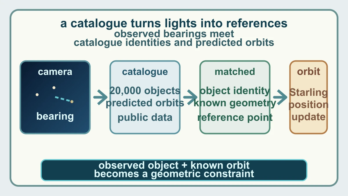
FALCON stands for Fast Autonomous Lost-in-space Catalog-based Optical Navigation. NASA describes it as a joint flight experiment with EraDrive, a company spun out of Stanford, combining EraDrive's Era-Core flight software and embedded algorithms with Starling's cameras and an onboard catalogue of known satellites. The catalogue supplies the missing link between a moving light in an image and an object whose orbit can be predicted.
For the experiment, the mission team loaded a catalogue of approximately 20,000 space objects and their predicted orbits onto the spacecraft. FALCON correlated those predictions with the objects observed by the cameras. Once an observed object was matched to a catalogue identity, its expected position supplied a geometric reference point. A set of such references can constrain Starling's own orbit, while the same observations can also improve predictions for the objects being tracked.
NASA reports that during a three-day period FALCON improved the known orbits of more than 200 objects without intervention from operators on the ground. That result contains two related but distinct achievements: the spacecraft used relative optical references for self-orbit determination, and it refined catalogue information about other objects. Starling's earlier StarFOX experiment also used star trackers for relative swarm navigation, but StarFOX and FALCON should not be collapsed into one system; the catalogue-matching step is the defining idea here.
FALCON is a flight demonstration, not a GPS replacement
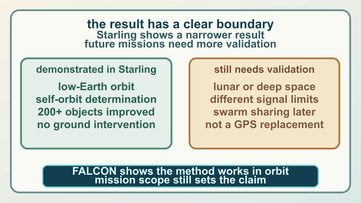
The strongest claim supported by the new report is specific. FALCON demonstrated self-orbit determination for a spacecraft using optical cameras and the relative position of other objects in low-Earth orbit. It also produced better object-position predictions onboard Starling than the current catalogue data in the reported tests. Those are meaningful flight results because they happened with the spacecraft observing its environment and processing the relationship between an image and a known orbit.
The broader reason to care is that future spacecraft networks may not always have a reliable navigation signal or a fast ground link. NASA points to lunar satellite swarms, distributed science missions, human exploration and space-traffic monitoring as possible areas where autonomous navigation and catalogue updates could reduce dependence on ground networks. But a possible application is not a demonstrated capability. Lunar distance, lighting, object visibility, catalogue completeness, camera performance and communications architecture can all change the problem.
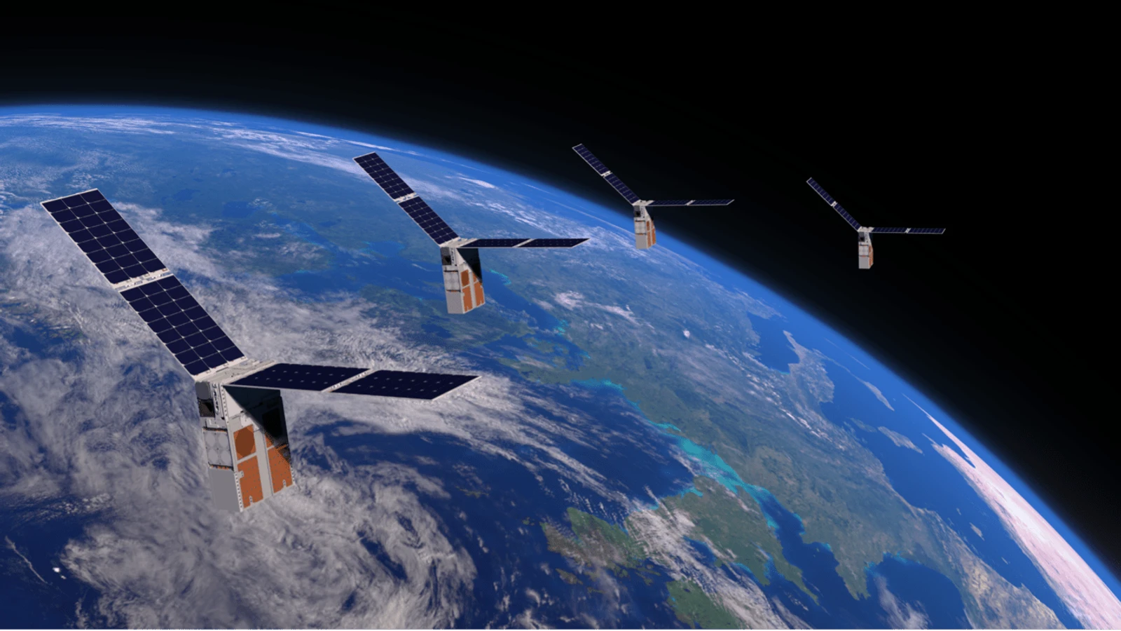
Starling's next extension is planned to let its four-spacecraft swarm share tracking data and refine positions collectively. That is a useful next experiment, not proof of universal deep-space navigation. FALCON shows how a camera observation can become a navigation reference when it is matched to known geometry. It does not show that every spacecraft can replace GPS, that a single image gives a full orbit, or that the method is operationally ready for every mission. The honest payoff is narrower: autonomy begins when the spacecraft can turn what it sees into a checked relationship with what it already knows.
Sources and further reading
- NASA: NASA's Starling Mission Opens New Frontiers in Space Navigation ↗
- NASA: Starling mission ↗
- NASA: Swarming for Success: Starling Completes Primary Mission ↗
- Stanford Space Rendezvous Laboratory: FALCON project ↗
- arXiv: Starling Formation-Flying Optical Experiment: Initial Operations and Flight Results ↗
- NASA Images and Media Usage Guidelines ↗
This article was written for Curiosity Desk. We do not copy other publishers or invent quotes. If a material error is found, we correct it openly.
Read the full standards →One answer should lead to a better question
Bring your curiosity to the group
Curious Minds is our public Facebook community for surprising science, strange history, Australian wildlife and everyday questions. No copied posts, no personal-friend invitations and no link dumping.
- Three self-contained discussion prompts each week
- Sourced answers and honest uncertainty
- Respectful conversation without spam